- Industry Collaborators
- People
- News
- News (archives)
- Research News
-
Doctoral Research
- - Augustine Kukah
- - Aziz Shaikh
- - Damith Liyanage
- - Elham Shokri
- - Emmanuel Litonjua
- - Fredrick Boamah
- - Hasan Zaidi
- - Hashem Mir Ahmadi
- - Iresha Gamage
- - Kola Olayiwola
- - Kushani Semasinghe
- - Mathusha Francis
- - Mazdak Irani
- - Mohamed Abdellah
- - Mohammed Hummadi
- - Mona Jahangir Zadeh
- - Mostafa Yousefi
- - Namal Gamage
- - Nedal Hassan
- - Olly Harouni
- - Prasad Perera
- - Prakriti Pokhrel
- - Sachindra Hewavitharana
- - Seva Watts
- - Shashini Jayakodi
- - Shiyamini Ratnasabapathy
- - Simone Khiralla
- Research Projects
- Publications
- Roundtables
- Community of Practice
- Future Constructors
- Digital Media Repository
A Knowledge-Based Approach for Vulnerability Assessment of Buildings Due to Land Subsidence Using LIDAR, InSAR and GPS Data Over Sydney, Australia
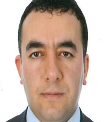
PhD Candidate: Mr Olly Harouni

Supervisory Panel
| Principal Supervisor: | Associate Professor Payam Rahnamayiezekavat |
| Co-supervisor: | Dr Maria Rashidi |
| Co-supervisor: | Adjunct Professor Alan Forghani |
Abstract
According to UNESCO, land subsidence is a subsidence that occurs on a large scale for a variety of reasons. It is commonly referred to as the vertical downward movement of the earth's surface that can be accompanied by a slight horizontal vector. This definition does not include phenomena such as landslides because their motion has a significant horizontal vector, as well as subsidence in manual soils, which have a different mechanism. Land subsidence has occurred in many parts of the world, especially in densely populated deltas. The phenomenon has affected more than 150 regions worldwide, including Mexico City, Thailand, China, Italy, Iran, Australia, Japan and the United States. On the other hand, among the countries of the world, Australia occupies about 5% of the land area; with its highly variable rainfall patterns, it is known as the driest inhabited continent on earth. Only about 12 percent of Australia's rainfall is reported to fall into rivers or be stored as groundwater yearly, with the remaining 88 percent evaporating into the atmosphere. This has exacerbated the phenomenon of land subsidence in Australia. Accordingly, the use of methods to predict the occurrence of this phenomenon to make strategic decisions in this region is of great importance. One of the new methods of detecting this phenomenon is using technologies based on remote sensing. In recent years, new remote sensing methods such as LiDAR, ADinSAR, PSI, and small baseline subsets (SBAS) have been used to assess and measure the subsidence of buildings, structures, and lands. Therefore, the present study tries to evaluate and estimate the vulnerability of buildings to subsidence due to subsidence in Sydney, Australia, using knowledge-based methods and based on data obtained from LiDAR InSAR images.
Biography
With over 21 years of experience in the engineering and construction industry, Olly Harouni is a highly accomplished Project Manager specialising in project planning, tendering, and end-to-end project management. Recognised for consistently delivering projects within allocated timeframes and under budget, his expertise extends to effective stakeholder management, fostering enduring relationships with internal and external parties, subcontractors, and clients. Holding credentials such as an IBM Data Science Professional Certificate, approval for Chartered Engineer (TMIEAust CEngT), a Master of Advanced Engineering (MAEN), and more, he emphasises high-level technical capability and analytical skills for evidence-based project solutions.
As a Consultant Engineer in various Engineering Groups and the Director/Consultant Engineer at Dr Building Solutions Pty Ltd, his career reflects entrepreneurial acumen. Notable roles include General Manager/Project Manager at PP&C Contractors Pty Ltd and positions in esteemed organisations like Manteena Pty Ltd and LAR Consulting Engineers. Committed to safety, exceptional communication skills and effective leadership, he is a sought-after professional in the industry.
Education
- IBM Data Science Professional Certificate, IBM (2022)
- Approved for Chartered Engineer (TMIEAust CEngT), Engineers Australia (2021)
- Master of Advanced Engineering (MAEN), University of Southern Queensland, Australia (2021)
- Approved for National Engineering Register (NER), Engineers Australia (2021)
- Diploma of Project Management for Engineers, Engineers Australia (2020)
- Approved for ACT General Building Surveyor, ACT Construction Occupations (2019)
- Approved for WA General Building Surveyor, WA Department of Mines, Industry Regulation and Safety (2019)
- Graduate Diploma of Built Environment (Building Surveying), University of South Australia, 2018
- Approved for ACT Builder’s License ‘B’ Class, ACT Construction Occupations
- Bachelor of Science in Civil Engineering, Azad University of Ahvaz, Iran (2002)
Professional Affiliations
- Surveying & Spatial Sciences Institute AIBS (Australian Institute of Building Surveyors)
- AGS (Australian Geotechnical Society)
- Engineers Australia
- ASPRS – Imaging and Geospatial Society
Research Interests
- Remote sensing technologies for land subsidence
- Impact of environmental factors on land subsidence
- Data-driven approaches for vulnerability assessment
- Risk mitigation strategies for urban areas
- Integration of climate change in subsidence models
- Cost-effective monitoring techniques
Related Publications
Journal Publications
- Harouni, O., & Forghani, A. (2022). A Review of Application of LiDAR and Geospatial Modeling for Detection of Buildings Using Artificial Intelligence Approaches. World Journal of Geomatics and Geosciences, 2(1), 47–59. DOI: 10.31586/wjgg.2022.477
Contact
| Email: | 18318018@student.westernsydney.edu.au |
| Location: | Parramatta |
| LinkedIn: | https://www.linkedin.com/in/olly-harouni-33115031/ |
Disclaimer
The content of this page is based on the information provided by the profile holder.
Mobile options:

